Go With The Workflow
Published by Jessica Casey,
Editor
Global Mining Review,
Unmanned aerials vehicles (UAVs) – or drones – are showing up in the skies above mines all over the world. From exploration to mapping to monitoring, UAVs are being used to perform more and more functions on job sites.
As the use of this technology becomes more prevalent, many in the mining industry have questions about what it would look like to incorporate drones into their core operations. Exploring the workflow involved in specific case studies can give potential users insight into the process as they evaluate whether drones make sense for their businesses.
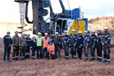
Jaume Cazorla Milla is a Geospatial Engineer for Microdrones, a company that develops professional-grade UAV solutions for surveying and mapping. He has travelled to dozens of mines to walk potential and new users through the process of using drones to achieve tasks that can otherwise be tedious, time-consuming and dangerous.
“My goal is to demystify drone use,” explained Cazorla, “so professionals in the mining industry can seriously consider how this technology might help them be more efficient, safe and profitable.”
Cazorla recently worked with a coal mining company that wanted to test out using UAV-based LiDAR to accomplish a task that happens regularly on their job sites: calculating soil volume. The goal was to conduct an aerial survey of the mine’s irregular terrain and then create a 3D point cloud and digital surface model (DSM) using the data collected. The company would normally survey the mine in a traditional manner, with GNSS RTK receivers, but were interested to try the drone to see if it would improve their efficiency.
“Completing the project the way the company usually does takes two men working 8 hours per day for 3 - 5 days,” said Cazorla. “With the Microdrones mdLiDAR1000, they were able to significantly reduce the amount of time, flying the project in about 2 hours and processing the data that same day.”
There is a growing awareness of the potential of drones to save time and access hard-to-reach areas on the job. Many companies are invest-ing time, research and capital to ascertain the specifics of implementing drone surveying and selecting the best tool for the job.
“If you have a fully integrated solution that works well for mining, the process should be simple,” commented Cazorla, as he began detailing the workflow for the coal mine project. “Many clients are surprised by how easy it is once they try it. However, there are some considerations unique to the mining industry that are helpful to know when getting started.”
Exploring the drone surveying workflow
“With every job that we do at Microdrones, we follow a basic workflow of plan, fly, process and visualise,” said Cazorla. “The details involved in each of those steps depend on the requirements of the project, but those elements are involved in every project.”
During the planning phase of the coal mining company’s project, the first step was to define the area of interest, the deliverables and the requirements (Table 1). Once these were outlined, Cazorla could help the project team to determine expected error, the processing parameters and how the flight should be carried out.
| Table 1. Project requirements | |
| Technology | LiDAR |
| Deliverables | Point Cloud |
| DSM | |
Accuracy Z for σ | 10 cm |
| Grid of the DSM | 1 point every 10 cm |
| Time frame data collection | 1 day |
| Coordinate reference system | CTRF 2000 |
| Projection | CGCS2000 CM111E |
| Vertical reference datum | Ellipsoidal H |
The company wanted to create a point cloud and DSM with an accuracy of 10 cm in the Z-axis and a grid of one point every 10 cm. Because the 1 km2 area that had to be surveyed consisted of steep and irregular terrain, Cazorla chose the company’s mdLiDAR1000 solution for this mission.
LiDAR stands for Light Detection and Ranging. The LiDAR sensor emits a laser that measures the various distances to the surface of the earth, data that is necessary to create a DSM.
“LiDAR is a desirable approach for most mining projects because it allows for significant time savings when compared with photogrammetry methods,” explained Cazorla. “The mdLiDAR1000 includes every-thing necessary for the job, including the md4-1000 unmanned air-craft, a fully integrated LiDAR sensor and camera and all the necessary hardware and software. Also, this solution is smaller and lighter than our mdLiDAR3000, so that makes it easier to transport and carry.”
The second part of this article is available here.
Read the article online at: https://www.globalminingreview.com/special-reports/21092020/go-with-the-workflow/
You might also like
Eurasian Resources Group and BAUER launch the world’s first vertical bauxite mining project
The Krasno-Oktyabrskoye Bauxite Mining Unit (KBRU) of Aluminium of Kazakhstan JSC, owned by Eurasian Resources Group (ERG), a leading global metals and mining company, has officially launched a project focused on the vertical extraction of bauxite using rotary drilling.