A Tipping Point In Aerial GIS Tech
Published by Jody Dodgson,
Editorial Assistant
Global Mining Review,
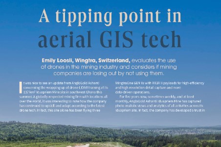
It was nice to see an update from AngloGold Ashanti concerning the wrapping up of drone LIDAR training at its 137 km2 Iduapriem Mine site in southwest Ghana this summer. A globally-respected mining firm with locations all over the world, it was interesting to note how the company has continued to upskill and adapt according to the latest drone tech. In fact, this site alone has been flying three WingtraOne GEN IIs with RX1R II payloads for high-efficiency and high-resolution detail capture and more data-driven operations.
For five years now, sometimes weekly, and at least monthly, AngloGold Ashanti Iduapriem Mine has captured photo-realistic views and analytics of all activities across its Iduapriem site. In fact, the company has developed a trust in drone technology to the point where it no longer puts its traditional ground-based surveyors in unsafe or inaccessible areas. Considering that most sites have to pay a lot for high risk insurance for each surveyor, this is a considerable per-annum cut in overhead. There is also the bonus of no incidents, site shutdown, and lawsuits should someone fall on a rock face or be in the wrong place at the wrong time when some rocks decide to fall.
The other nice side effect of these remote surveys is that activity on the ground can continue as usual. Especially when using a fixed-wing vertical take-off and landing (VTOL) drone, a single-man crew can squeeze a whole site survey into a tight weather window or get some on-demand update without any machinery or work downtime.
What are mines using drone data for these days, besides the obvious?
Mines have always needed surveys to scout locations, plan and track earthwork, monitor pre and post drill and blast, and check in on highwall stability and haul road profiles. This is all not to mention checking the integrity of tailings dams and tunnels. Whether they be multirotors for close vertical asset inspection, tunnel drifting indoor drones, or fixed-wing VTOLs like Wingtra, drones today put surveys on steroids – availing millions of data points to analyse anything from rock faces to haul-road stability to post-blast efficacy.
The LIDAR drone payload integration AngloGold Ashanti’s Iduapriem Mine just completed highlights even more ways that this data saves time and resources, however. Training with Wingtra partner TerraCam, the company focused on the benefits of LIDAR capture across targeted areas to monitor assets such as power line sagging, vegetation encroachment, village encroachment, and nearby illegal mining.
Drone LIDAR is at a state of maturation now where it is reliable. For mines surrounded by vegetation, it picks up the information needed to keep infrastructure functioning safely and sites secure.
This is a preview of an article that was originally published in the October 2025 issue of Global Mining Review. Subscribe to Global Mining Review for free to read this article in full and many more here.
Read the article online at: https://www.globalminingreview.com/special-reports/12112025/a-tipping-point-in-aerial-gis-tech/
You might also like
Driving Mining Performance with Precision - How VEGA’s Measurement Technology Supports Reliable Operation Worldwide
Mining operations across the globe face severe environmental and technical challenges. Extreme temperatures, humidity, dust, abrasive slurries, and corrosive atmospheres place continuous strain on equipment.