Ibrahim Amin, Deputy Manager – Mine Planning & Reconciliation, Sindh Engro Coal Mining Company (SECMC), describes how drone-based surveying at Thar Coal Mine cuts survey turnaround from 8 – 10 days to one day, reduces personnel exposure by about 90%, and provides detailed spatial data for faster operational decisions.
Mining is a dynamic operation in which production, overburden removal, and changing terrain demand frequent and accurate surveys. As opencast mines expand, conventional surveying methods face a growing challenge: delivering reliable measurements quickly enough to support production, commercial reconciliation, and mine planning without exposing survey personnel to operational hazards. At large mines, surveying is no longer simply a matter of collecting ground measurements; it is a time-critical function with direct implications for efficiency, safety, and cost control.
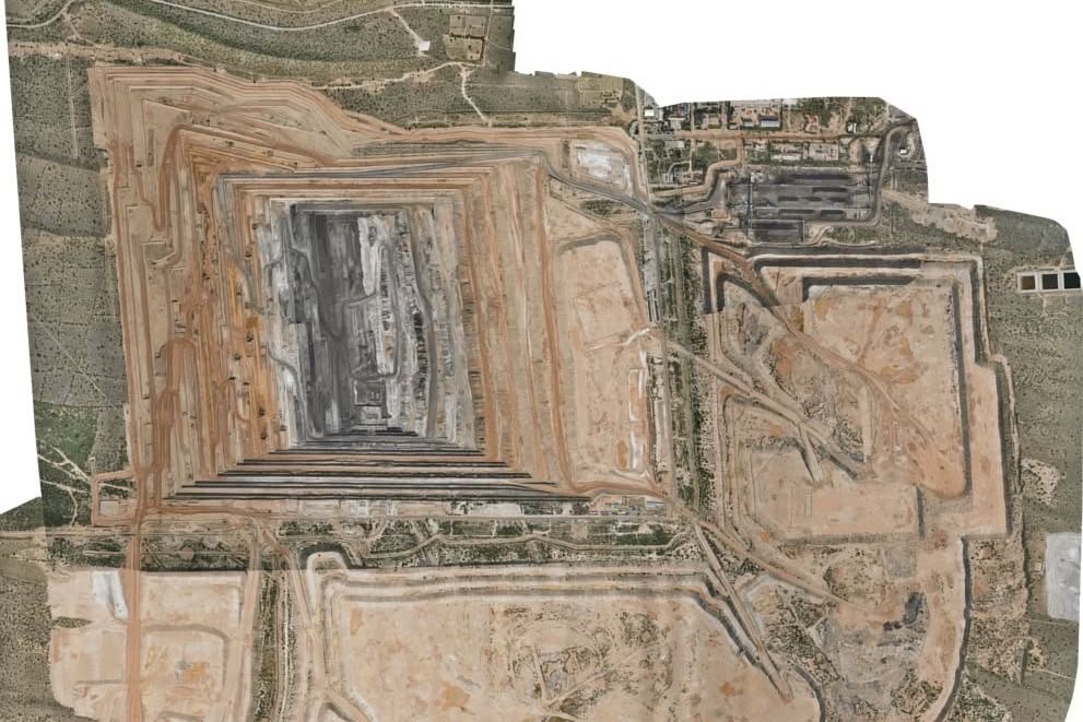
The challenge is evident at Thar Coal Mine Block II in Tharparkar, Sindh, Pakistan, operated by SECMC. Since commercial operations began in 2019, the mine’s lignite production capacity has increased from 3.8 million tpy to 11.2 million tpy in seven years, nearly tripling its initial capacity. The approximately 23 km2 operation requires around 70 million billion m3 of annual overburden removal and deploys more than 350 units of primary and auxiliary mining equipment. Under its contractor-based operating model, where mining activities are compensated at unit rates per bank m3, accurate and timely measurement is essential for verifying excavation volumes, reconciling production, and supporting commercial transactions.
Conventional ground-based surveying presents two principal constraints: the time required to cover a large and continuously changing mine, and the limited density of data collected. Instruments such as total stations and differential GPS capture observations at selected ground points, with the intervening terrain interpolated to generate surface models. While established and useful, this approach may not fully represent complex bench faces, localised failures, and detailed changes in excavation profiles. Moreover, survey personnel must spend extended periods navigating active mining areas, where moving equipment, uneven terrain, highwalls, dust, and heat create additional exposure.
Drone-based surveying addresses both constraints by capturing overlapping aerial geo-referenced photographs that can be processed into detailed, surface models. Rather than relying primarily on discrete ground observations, photogrammetry generates dense spatial datasets containing millions of points. These datasets provide a more comprehensive representation of the mine surface, supporting volume calculations, progress monitoring, mine-plan compliance, and geotechnical and safety assessments.
At Thar Coal Mine, survey and reconciliation team uses a WingtraOne Gen II unmanned aerial vehicle equipped with a 61 megapixel camera. Flight missions cover the stockyard, mine pit, and waste dumps, while ground control points support accuracy and independent checks. The resulting imagery is processed using photogrammetry or geographic information system software to generate orthomosaics, digital elevation models, contours, and volumetric outputs.
The reported efficiency gains are substantial. Surveying the 23 km2 site conventionally takes 8 – 10 days, compared with just one day using drone technology. This represents a 90% reduction in survey turnaround time, or an operation completed 10 times faster. Personnel exposure to site hazards also declines from approximately 320 – 400 person-hours to around 30 hours (a 90% reduction). The drone survey is completed by a three-person team comprising one UAV pilot and two personnel responsible for placing and surveying ground control points.
These gains extend beyond the survey team. Faster access to updated spatial data accelerates monthly excavation-volume calculations and provides mine planners, geotechnical and safety teams, and dewatering personnel with a shared view of site conditions. This supports more timely operational decisions while reducing the need for repeated field visits.
Drone surveying does not eliminate the need for ground control, accuracy checks, or conventional methods where these remain appropriate. Its effectiveness depends on sound flight planning, data processing, and quality assurance. Nevertheless, the reported results demonstrate a clear operational advantage: less time spent surveying, substantially lower personnel exposure, and richer spatial information. For large opencast mines, these are measurable efficiency gains that can strengthen the reliability and responsiveness of mining operations.